





Close
2026 Taiwan Int'l Tools & Hardware Expo x Int'l Hardware Expo Taiwan (TiTE x IHT)
ACHEMA MIDDLE EAST 2026

RIEGL and DMT collaborate on tailored mining monitoring solutions

Note* - All images used are for editorial and illustrative purposes only and may not originate from the original news provider or associated company.

Subscribe

- Never miss a story with notifications

- Gain full access to our premium content

- Browse free from any location or device.

Media Packs

Expand Your Reach With Our Customized Solutions Empowering Your Campaigns To Maximize Your Reach & Drive Real Results!

โ€“ Access the Media Pack Now

โ€“ Book a Conference Call

โ€“ Leave Message for Us to Get Back

Related stories

China, Australia Expand Ties on Entire Mining Value Chain

In a recent development, the Chinese and Australian companies...

World First Vertical Extraction Mining of Bauxite Launched

The Krasno-Oktyabrskoye Bauxite Mining Unit - KBRU of Aluminium...

Saudi Arabia Lays $2.5t Investment Options to France, Europe

Saudi Arabia lays $2.5t investment options to French, European...

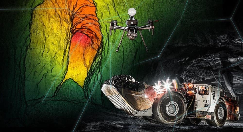
In a joint development between RIEGL and DMT, the RIEGL VZ-400i and VZ-2000i 3D terrestrial laser scanners are now being integrated into the DMT SAFEGUARD monitoring platform to, RIEGL says, offer innovative and tailored monitoring solutions for the mining and infrastructure industries.

The open architecture of the RIEGL VZ-400i and the RIEGL VZ-2000i 3D Terrestrial Laser Scanner allows customisation of the scanner for complex data acquisition and processing tasks by means of Python scripts and Python-based apps. RIEGLโ€™s Online-Waveform-Processing technology ensures high quality data, while 24/7 fully remote operation is proven, it says. Laser scan data is processed by integrated apps in real time on the scanner, with final results visualised via a web viewer tool.

With DMT SAFEGUARD a precise integration of RIEGL VZ-i Series scanners into a web-based platform is available, according to RIEGL. The individual customisation options allow additional sensors to be integrated directly on site, or external data sources integrated as well. GIS functionalities allow the integration of maps in order to display the most important data, with real-time documentation options, document management, an automated real-time assistance system and sophisticated reporting completing the service.

The new system provides real-time, exhaustive geospatial information and all decision-relevant parameters such as deformation values are available on demand from anywhere on the globe, RIEGL concluded.

Never miss a mining headline

The mining industry moves fast โ€“ stay on top of it with our must - read briefings.

  • The top mining and resources stories, straight to your inbox
  • The biggest news, features, interviews, and analysis
  • Dedicated coverage of the key developments shaping global mining and mineral markets

Latest stories

Related stories

China, Australia Expand Ties on Entire Mining Value Chain

In a recent development, the Chinese and Australian companies...

World First Vertical Extraction Mining of Bauxite Launched

The Krasno-Oktyabrskoye Bauxite Mining Unit - KBRU of Aluminium...

Saudi Arabia Lays $2.5t Investment Options to France, Europe

Saudi Arabia lays $2.5t investment options to French, European...

Beyond the Visible Spectrum: How SAR is Revolutionizing Mineral Exploration

Given the circumstances surrounding this activity, mineral exploration has...

Subscribe

- Never miss a story with notifications

- Gain full access to our premium content

- Browse free from any location or device.

Media Packs

Expand Your Reach With Our Customized Solutions Empowering Your Campaigns To Maximize Your Reach & Drive Real Results!

โ€“ Access the Media Pack Now

โ€“ Book a Conference Call

โ€“ Leave Message for Us to Get Back

Translate ยป