Mining Frontier
  • Home
  • News
  • Press Releases
  • Market Reports
  • Sectors
    • Aluminium
    • COAL
    • COPPER
    • DIAMONDS
    • GOLD
    • IRON ORE AND MANGANESE
    • NICKEL
    • NIOBIUM
    • PHOSPHATES
    • PLATINUM
    • STEEL
  • Projects
  • Events & Conferences
  • Contact US
  • More
    • Newsletter Archive
No Result
View All Result
Mining Frontier
No Result
View All Result
Home Asia Pacific

30cm Accuracy Topography for Mining

March 19, 2016
in Asia Pacific, News

PhotoSat’s 30cm accuracy satellite topographic mapping shortens timelines and saves costs throughout the mining exploration and production process.

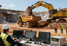
Mining engineers are using our topographic data for:

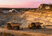
  • Open pit mining volumes.
  • Improving volumetric change calculations in leach pads and stockpiles, and measuring and monitoring tailings.
  • Mapping toes and crests and eliminating the need to expose ground survey crews to hazards.
  • Accurate elevation data for mine site planning and construction, feasibility studies, and reserve and resource estimates.
  • Improving the accuracy and reliability of drill hole collar coordinates for resource estimates and feasibility studies.
  • Mining exploration, including project base mapping and structural geology.


Experience

PhotoSat has completed over 600 international topographic mapping projects since 2004:

  • Over 600 Highly Accurate Satellite Topographic Mapping Projects
  • click to view larger image
  • Highest accuracy


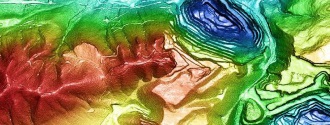
PhotoSat produces the world’s most accurate 1m bare earth topographic grids with 1m contours from satellite photos using our unique geophysical stereo satellite processing system. We produce mine surveys with 4 times the elevation accuracy of conventional satellite elevation mapping. Our accuracies have been proven using tens of thousands of ground survey points for comparison. View our Proof of Accuracy Reports.

To achieve 30cm accuracy PhotoSat uses a unique and proprietary set of algorithms that were derived from oil and gas seismic processing. Find out more about our data processing methods on the Technology page.

PhotoSat topographic mapping benefits:

  • Engineering quality topographic mining surveys available globally.
  • Simplifies the surveying process:no in-country presence or permits.
  • Cost-effective alternative to ground surveying, LiDAR and ortho photogrammetry.
  • Minimizes the exposure of field crews when accessing hazardous or remote areas.
  • Custom formats and projections.


Satellite topography pricing

The digital topographic data package is provided on a project-by-project basis. Please provide us with the extents of your project area and we will prepare a quote.

Package Includes:

  • 1m bare earth digital topographic grid (DEM)
  • 50cm or 1m contours
  • 50cm satellite ortho photo
  • 1m colour elevation image
  • 1m slope direction (aspect) image

Previous Post

Deflector Gold Project, Murchison, Australia & its Infrastructure facilities at the Deflector gold project

Next Post

Canadian junior Strongbow Exploration Inc announced on Friday the acquisition of the South Crofty tin mine in Cornwall

Related Posts

South Africa Revives Mining Endeavors
News

To Keep Pace Globally, South Africa Revives Mining Endeavors

May 19, 2025
Mining Projects in America
News

Mining Projects in America Getting the Executive Order Push

May 19, 2025
Coal Exploration Programme
News

Coal Exploration Programme Gets a Go Ahead in Canada

May 19, 2025
Mining StartUps Looking for Better Europe Avenues
News

Mining StartUps Looking for Better Europe Avenues

May 19, 2025
COAL

Decarbonising Coal Mining towards Emission Free Future

March 25, 2025
Aluminium

Aluminum Premiums Hit Record After Tariff Hike

March 22, 2025
Next Post

Canadian junior Strongbow Exploration Inc announced on Friday the acquisition of the South Crofty tin mine in Cornwall

No Result
View All Result

Recent Posts

  • METAL CHINA/DIECASTING/NONFERROUS CHINA 2025 Concluded with a Big Success
  • US on its Path Towards Exploring Rare Earth Elements
  • To Keep Pace Globally, South Africa Revives Mining Endeavors
  • The US Has the Option to Mine its Own Rare Earth Elements
  • Mining Projects in America Getting the Executive Order Push
Mining Frontier

System

  • Search
  • Sitemap
  • Feed

Resources

  • Contact US
  • Download Mediapack
  • Home
  • News
  • Press Releases
  • Market Reports
  • Sectors
  • Projects
  • Events & Conferences
  • Contact US
  • More

© 2019 Copyright Valuemediaservices All rights reserved.

No Result
View All Result
  • Home
  • News
  • Press Releases
  • Market Reports
  • Sectors
    • Aluminium
    • COAL
    • COPPER
    • DIAMONDS
    • GOLD
    • IRON ORE AND MANGANESE
    • NICKEL
    • NIOBIUM
    • PHOSPHATES
    • PLATINUM
    • STEEL
  • Projects
  • Events & Conferences
  • Contact US
  • More
    • Newsletter Archive

© 2019 Copyright Valuemediaservices All rights reserved.

Login to your account below

Forgotten Password?

Fill the forms bellow to register

All fields are required. Log In

Retrieve your password

Please enter your username or email address to reset your password.

Log In