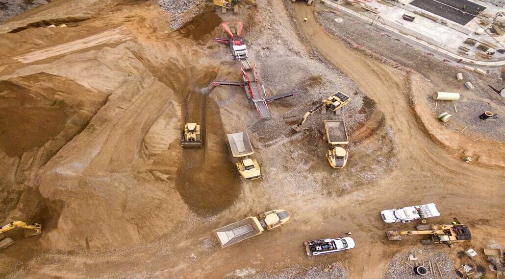
As high-quality mineral deposits in already developed areas dwindle, mining companies increasingly turn to remote locations for new resources. Mining in these areas can be both costly and time-consuming when conducted entirely in the field. Fortunately, remote sensing technology has revolutionized mineral exploration, offering efficient and accurate data collection for even the most remote and rugged terrain.
From electromagnetic imaging to topographical analysis, remote sensing enables mining operators to identify valuable resources while improving the efficiency and sustainability of operations.
A Brief History of Remote Sensing
Remote sensing in mining began with aerial photography, which detected signs of potential mineral deposits from above. While this method is still in use today, modern technology has improved significantly. High-resolution aerial photographs now enable miners to create detailed maps and detect signature geological features associated with mineral deposits.
Modern mining operations also incorporate sophisticated sensor-based imaging technologies that surpass aerial photography in terms of detail and capabilities.
Different Remote Sensing Technologies
Several advanced remote sensing technologies are used in today’s mining industry to locate and analyze mineral deposits. These include:
Hyperspectral Imaging: This technology captures electromagnetic radiation reflected or emitted by minerals, rocks, and other materials. Hyperspectral images can identify mineral signatures and the composition of surface and subsurface materials.
Light Detection and Ranging (LiDAR): Using laser pulses from aircraft or satellites, LiDAR produces detailed 3D topography maps. These maps reveal geological features that may indicate mineral deposits.
Radar: Radar imaging also generates detailed topography maps but is unique in that it functions in any weather condition or time of day.
Thermal Imaging: By capturing heat from the Earth’s surface, thermal imaging can identify geological features or processes associated with mineralization.
Each of these sensing technologies offers unique insights into target areas, and they are often used together to form a comprehensive model for exploration.
Applications of Remote Sensing in Mining
Remote sensing has wide-ranging applications in the mining sector, from exploration to sustainability practices:
Mineral Exploration: Remote sensing aids in the search for new mineral deposits by highlighting potential resource-rich areas and reducing the need for costly fieldwork.
Monitoring Mining Operations: Open-pit mining operations use radar images to monitor the slope stability of mines, helping prevent slope collapse and ensuring worker safety.
Water Resource Management: Operators utilize remote sensing to monitor water distribution around tailings storage facilities, track surface seepage, assess evaporation, and optimize water management for compliance and sustainability.
Toxic Gas Monitoring: Infrared imaging can detect vegetation contamination caused by toxic gases like sulfur dioxide or fluoride. Aerial photography can also identify areas affected by harmful gas release, such as reduced tree density.
Groundwater Pollution Assessment: Multispectral imaging is used to monitor vegetation affected by groundwater pollution. These insights inform remediation plans and reduce environmental impacts.
Latest Research and Developments
The field of remote sensing in mining is evolving rapidly, with exciting research and projects aimed at improving its accuracy and efficiency:
Geospatial Artificial Intelligence (Geo AI) By combining remote sensing data with machine learning algorithms, Geo AI enables precise analysis of massive datasets. For instance, deep learning models analyze high-resolution satellite photography and hyperspectral imaging to monitor land cover and vegetation changes. While promising, Geo AI currently faces challenges like limited training data and integrating data from multiple sources.
GoldenEye Project: Funded by the European Commission, this international project is developing an AI platform to monitor and analyze mining operations. Using data from satellites, drones, and land-based sensors, it aims to make mineral exploration safer, cost-effective, and more sustainable.
Conclusion
Remote sensing has become a cornerstone of the modern mining industry. By collecting key data on geological features, monitoring operational safety, and enabling sustainable practices, this technology is transforming how mining companies approach exploration and extraction.
As advancements like Geo AI and AI-driven platforms like the GoldenEye Project overcome challenges, remote sensing will continue to unlock resources in ways that are more efficient, cost-effective, and environmentally friendly


